By: Jeremy McClean
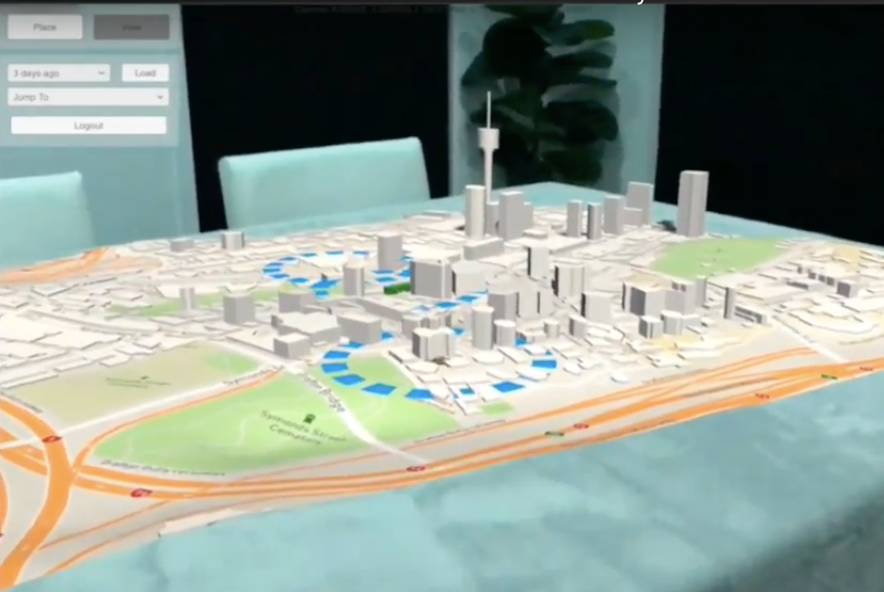
GPSengine, an Australia-based vehicle tracking platform, recently launched a unique demo with our Unity Maps SDK. The application communicates with the company’s existing platform to retrieve live locations of vehicles and historical journeys for replay. Jeremy McClean, Co-Founder & CEO of GPSengine, explains how his team built the project and where he thinks AR is headed.
What was the inspiration for the project?
Adding AR increases the amount of data we can display at a glance. We built this to demonstrate to our customers, what we see as the future of vehicle/asset tracking and IoT visualisation. We have been building vehicle tracking platforms for 12 years, so we are always looking for the next big thing. I personally think AR is the future of visualisation in general; it’s very likely going to replace 2D monitors.
What tools did you use to build the demo?
We built it using Unity, Unity-ARkit-plugin, and the Maps Unity SDK. It has about 50 c# scripts and about 10 shaders. Some shaders were developed using ShaderForge. We also bought a few miscellaneous assets from the Unity Asset Store for vehicles to place on the map.
Why did you decide to use the Maps Unity SDK?
The advantage for us was that it enabled us to include an attractive 3D map within our application without implementing the vector layer parsing and geometry generation code ourselves. This was critical for this project because we wanted to put it together in a few weeks.
What challenges did you encounter, how did you solve them?
We wanted to place a slippy map on a surface in AR, so the map had to “clip” to the size of the surface rather than scale-to-fit. To achieve this we used custom shaders for all of the map objects and injected the transform volume within which they should clip at runtime.
We also included a water layer using a Vector Layer Visualiser over the map. This was fine when overlaid over a flat map, but when using contoured terrain, the terrain would protrude through the water geometry. We fixed the issue by using a shader for the terrain that didn’t write to the Z-Buffer so that the protrusions through the overlaid geometry wouldn’t be visible.
If you had a magic wand, what features would you add?
I’d love to see a “Levels of Development” facility for smooth transitions between scales. It would also be great to have textures of the real buildings to layer on the 3D geometry. Also, real locations and/or textures of trees and foliage to elevate the realism of the maps. I am aware that you can overlay a satellite raster over the terrain and/or the tops of buildings, but it’s not quite the same.
What are your next steps for the project?
We will keep adding to it. I want it to be a complete demo showing freely available info; for example — weather, bus routes, average road speeds, etc. We also want to show different use-cases like job dispatch, freight and logistics, smart cities, and IoT monitoring. We won’t stop playing with this.

Get started with our Maps Unity SDK documentation and tutorials. Check out some other great demos from our community of developers like this visualization of fog rolling into San Francisco or this location-based game we built in 20 minutes.
GPSengine (@GPSengine) | Twitter
GPSengine and the future of AR: How I built it was originally published in Points of interest on Medium, where people are continuing the conversation by highlighting and responding to this story.