Quantcast
Channel: maps for developers - Medium
Viewing all 2230 articles
Browse latest View live

Building the future of mobility with Luxoft

$
0
0

By: Alex Barth

Mapbox is focused on enabling developers and car makers to build sophisticated AI and AR in-car applications, with maps that understand the driver’s environment from both a street-level perspective and a bird’s-eye view. We are excited to expand our relationship with Luxoft to accelerate this vision and to satisfy increased demand for in-car innovation.

Today in Detroit we’re with Luxoft at the annual TU Auto connected car conference showing our new front-facing Vision SDK that uses the camera to describe as data every curb, lane, street signs, and road hazard it sees. Now, developers can deliver precise navigation guidance, display safety warnings at the right time, and easily run custom workflows for collisions and other road conditions.

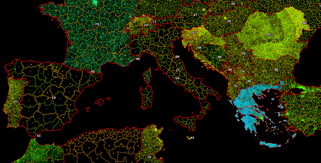
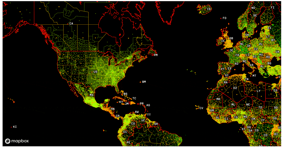
Accuracy powered by AI: Every month, more than half a billion monthly active users touch our maps via applications built with Mapbox — generating more than 300 million miles of driving data a day. This results in Mapbox incorporating more than 100,000 anonymized location updates per second: data to continuously detect unexpected traffic and slow-downs. Mapbox Traffic covers 161 countries and updates at a 5-minute granularity for 2.3 billion road segments around the world.

The Mapbox Vision SDK delivers a 3D view of where the driver is, working in tandem with the Navigation SDK to project the route ahead. Shift map perspective, mark important landmarks, or provide lane-level routing using Vision SDK’s AR projection mode.

Understand the driver’s environment: Our navigation combines maps with front-facing sensors and uses AI-powered semantic segmentation, object detection, and classification to identify the variables that define a driver’s journey. Detect construction, recognize street signs and speed limits, and identify potential hazards to ensure a safer, more informed drive.

Real-time alerts: Track and assess environmental variables to guide the driver. Vision SDK is part of our in-car navigation, detecting nearby cars, pedestrians, and traffic lights, and lets developers customize alerts based on the driver’s speed, proximity, and driving behavior. Developers can trigger actions based on situational awareness to match the driver’s needs in the moment.

A unique driver experience: Mapbox Navigation SDKs for Android, iOS, Linux, and webOS Auto allow car makers to craft unique navigation experiences tailored to their brand and drivers. Take control over every aspect of the map design and embed curated data such as parking, charge point and gas station data with Mapbox Studio and craft experiences that are unique to your drivers and brand.

Luxoft+Mapbox: This partnership makes Luxoft a technology and system integration partner for Mapbox navigation, AR, driver assistance and fleet management systems. A global force of 13,000 Luxoft engineers in 17 countries is helping our joint customers in automotive, to make more of the map platform faster with its digital strategy, consulting and engineering services at scale.

Catch us at TU Auto at Luxoft’s booth, get in touch with our partners at Luxoft or give one of our experts a call to learn more.

Alex Barth


Building the future of mobility with Luxoft was originally published in Points of interest on Medium, where people are continuing the conversation by highlighting and responding to this story.


Friendly workflows for creating maps

$
0
0

Itinerary Builder makes it easy to locate, annotate and publish

By: David Wicks

Maps and location add significant value to companies, driving more user engagement, and better insights.

Companies can differentiate themselves by showing their own data on top of the map, like points of interest, routes, curated itineraries, detailed place info, and more.

But gathering the data can be a pain point, especially for the customers I work with who are creating hundreds (or thousands) of maps for specific groups of users or use cases—travel companies mapping rich interactive itineraries, or real estate companies generating beautiful collateral showing each of their agents’ property listings.

Often, companies have large amounts of their own information, sometimes stored in ad-hoc systems, and they need to create a large number of unique ways to view that information (i.e. lots of maps.)

So we worked with our customers to solve the pain point with a friendly workflow tailored to their needs. We divided that workflow into three major steps: locating, annotating, and publishing.

The three steps are brought together in a single templatized application that makes it easier to produce maps for a specific goal.

Try the workflow for yourself with the Itinerary Builder Demo

Locating the data

The first step, locating the data, is about associating your data with geographic coordinates. Some companies already have longitude and latitude coordinates for all their information, which takes care of this step. For their production pipeline, we simply pulled in location data from their published API. A lot of companies, however, have only a name or address for places of interest. To locate those places, we used Mapbox’s search API and implemented a simple CSV-based workflow, allowing them to use their existing spreadsheets as a starting point for map generation.

Annotating the data

The bulk of production workflow time goes into annotating and authoring the map. In this phase, we choose what data to show on the map and contextualize it. For real estate companies, that context is often a selection of nearby restaurants, parks, and the public library. For travel companies, it usually includes places to stay and highlighted activities from their portfolio. Authoring is accelerated by working with a one-to-one representation of the final output, seeing annotation decisions on the map as they are made.

Publishing the data

Finally, we publish the data. While editing the data, it is kept in an easy-to-edit format, with restricted access for team members. During publishing, the data is converted to an easy-to-read format — either for humans or machines. Sometimes that format is a print-ready graphic. In others, it is a collection of all the relevant data that can be loaded on dynamic, customer-facing maps, stored on multiple edge servers for fast distribution. For most web maps, we choose to store the custom data as JSON, since it allows us to embed the geographic information with useful metadata that helps tell the story of the map.

To get a sense of those ideas in practice, try out the itinerary builder demo. It brings together the ability to locate your data in bulk or one point at a time, annotate the locations with nearby points of interest and your own comments, and publish it to an example user-facing map.

Try building your own workflows, or get in touch to discuss your process with our solutions team.

David Wicks - Solutions Engineer - Mapbox | LinkedIn


Friendly workflows for creating maps was originally published in Points of interest on Medium, where people are continuing the conversation by highlighting and responding to this story.

Global boundary data for offline maps

$
0
0

​​Introducing Atlas Enterprise Boundaries

By: Adam Koeppel

Financial institutions, insurance providers, and emergency response centers can now add national, regional, local, and postal divisions to their offline and on-premises mapping applications with Atlas Enterprise Boundaries, our latest feature for Mapbox Atlas.

The ability to join custom data with global and local boundary polygons facilitates deeper data-driven decision-making and insight into how your data relates to your geographical regions. Regional disaster response centers can use Enterprise Boundaries to determine jurisdiction for emergency response. Autonomous vehicle companies can use administrative boundaries to track mobile asset compliance with varying local, state, and national laws. Utilities and energy companies can visualize and assess localities affected by transmission infrastructure planning. And all of this can happen completely offline.

See all boundary data coverage: https://demos.mapbox.com/vt_coverage_map/

Assembling national, regional and local boundary data into data sets is surprisingly difficult. Different agencies produced data in different formats, and geospatial teams needed to gather, transform, and align this data. Atlas Enterprise Boundaries brings Mapbox’s curated boundary data to offline and on-premise customers, so you can precisely map national, regional and local boundaries wherever you are.

Atlas Enterprise Boundaries offers Atlas customers:

  • Detailed and Accurate Maps: Our Cartography team assembled detailed and precise edge-matched polygons. All boundaries within a hierarchy are matched with their parent polygons so you can have a pixel-perfect map visualization.
  • Optimized Vector Tiles: Mapbox serves Enterprise Boundary data tilesets as vector tiles. This allows Atlas customers to quickly visualize data on any medium, from mobile to web. You can seamlessly zoom through your data with thousands of polygons and interact with your data in a new way.
Drilling down on hospital spend.

Enterprise Boundaries is an additional product on your current Atlas Standard or Enterprise license. Contact your Atlas sales representative to add Enterprise Boundaries to your license, starting with a free trial period, and explore the Enterprise Boundaries getting started guide for inspiration.

Adam Koeppel - Product Manager - Mapbox | LinkedIn


Global boundary data for offline maps was originally published in Points of interest on Medium, where people are continuing the conversation by highlighting and responding to this story.

How The Pudding team uses Mapbox

$
0
0

Visual storytelling on population, music, and Wikipedia maps

By: Matt Daniels, Journalist-Engineer and Business lead/CEO at The Pudding

As a member of the visual journalism team at The Pudding, I’ve spent the past year exploring how to integrate Mapbox into our editorial process. The Pudding is a digital publication that explains ideas debated in culture with visual essays and maps are a crucial visual tool used to unravel some of the complexities of these debates. Among all of the mapping tools available, I’ve found Mapbox extremely useful for creative exploration without code, using Mapbox Studio, and then moving to full code-driven customization with Mapbox GL JS.

After repeating this process many times, I’ve encountered a few important use cases for using Mapbox as a storytelling and visualization tool. Here’s just a few:

Data-driven visualization on “Human Terrain”

Human Terrain” helps readers understand and observe the scale of population change globally over the past 30 years. This project involved hundreds of gigabytes of population data and creating 3D extrusions, which allowed readers to see details that could have been overlooked otherwise. I initially explored the idea of using a tool such as deck.gl or D3, but that required loading the population data into the browser. Even if done for a single location, I’d expect at least 10–20MB of data would need to be downloaded. Browsing a globe might require hundreds of megabytes of data.

By using Mapbox, I was able to render the data as tiles. Essentially, depending on where the reader was viewing the map (and at what zoom level), only the necessary data was loaded in Mapbox’s nifty vector tile format. An exploration of New York City’s population now only required a handful of image tiles, and Mapbox GL JS easily handled the 3D extrusions. In short, using tiles allowed the project to load and perform faster than any other alternative I explored.

Responsive map rendering on “Population Mountains”

As a complement to “Human Terrain”, “Population Mountains” takes a closer look at cities and the way we perceive their populations. In this version of the population data project, I wanted to render simple full-bleed images of certain areas. This meant that the size and zoom needed to fit the reader’s browser size. Instead of downloading specific resolutions (and stretching the image), I used Mapbox’s Static API to render a map that was the exact width and height of the reader’s browser.

For each city, I also wanted to show its population at several zoom levels. By using the Static API, I didn’t have to re-download the image after making a small change. Mapbox loaded the latest version of the map as a PNG according to any parameters specified in the URL.

Complex choropleths on “The Cultural Borders of Music”

Last year, I had a vision for a map that would show the most popular song with the most detailed geography I could find. I ended up using YouTube music data, which allowed me to visualize the data by city. In an ideal world, I’d be able to create a map that showed the exact geographic line where the most popular song changed.

In order to do that, I used Mapbox Boundaries. I used each city’s latitude and longitude against the equivalent of US counties, postal boundaries, or administrative regions.

Using the Tilequery API, I could retrieve the data for each geographic boundary. This allowed me to create an incredibly complex choropleth, where areas of the world are color-coded against its most popular song, allowing readers to discover musical regional trends.

Collision detection on “People Map”

For our latest project, we created a dataset of famous residents from every US city (using Wikipedia). The result was something akin to “every city’s most famous resident,” a riff on a common phrase you might find when entering new cities; for example, Great Barrington, MA, home of W.E.B. Du Bois. We also made a UK version of the map, available here.

But visualizing thousands of cities on a map is difficult. 20th-century mapmakers relied on careful spacing and font sizing to display a dense amount of information. With interactivity at our fingertips, we used a method known as collision detection.

For example, here’s what the data looks like if we were to map each city’s most Wikipedia’d resident, without collision detection:

Mapbox has out-of-the-box collision detection. It knows when text is overlapping and we can feed it some logic to prioritize certain label’s visibility based on its importance.

In this case, we only show the most popular Wikipedia pages in the entire dataset. From there, we create new layers at a lower priority, so if there’s enough space, they’ll appear on the map.

This is especially useful at different zoom-levels, where white space opens up as we zoom in on the US, allowing for names to be displayed.

To aid readers’ understanding of where labels are hidden, we added in green circles with a radius based on the number of Wikipedia views. We also used data-driven styling to set the font size of the labels, resulting in a clean and clear label-filled map.

We’re very excited to continue to use Mapbox for visual, cartography-driven storytelling. If you have any questions about these projects and the technical implementation, absolutely reach out to our team: sup@pudding.cool.

Matt Daniels (@matthew_daniels) | Twitter


How The Pudding team uses Mapbox was originally published in Points of interest on Medium, where people are continuing the conversation by highlighting and responding to this story.

Mapbox modules for Alteryx

$
0
0

Search, Isochrones, and Spatial Lookup

By: Chris Toomey

From the early days of Alteryx, location data and geospatial analysis have always been front and center, and we are excited to be part of the Alter Everything movement.

Today Mapbox is announcing a public beta for three new Alteryx Modules: Search, Isochrones, and Spatial Lookup (powered by Mapbox Boundaries). All three modules leverage our world-scale APIs, so once they are in your workflow, you have global, accurate datasets at your fingertips.

Here’s a bit more detail about each module:

Search

The Search module will transform your structured data into usable location data. If that sounds like geocoding — it is!

What kind of data can you search for?

  • Countries: Generally recognized countries, or administrative entities with a designated country code under ISO 3166–1 (that’s a fancy way of saying — if you think it’s a country, it probably is).
  • Regions: Top-level administrative areas like states in the USA or provinces in Canada or China.
  • Postcodes: Postal codes used in country-specific national addressing systems (your results should be normalized to the country in which you query.)
  • Places: Cities, villages, and municipalities.
  • Addresses: Individual residential or business addresses.

When you run the Search module, you will get the coordinates themselves as longitude and latitude columns as well as an Alteryx-encoded point. If the module returns no data, you will also get the list of all data that couldn’t be found (in case you want to clean it up and try again). You will also get additional metadata about your results, including a reference to the place type, the relevance of our result to your specific query, and a qualitative accuracy metric for the data.

We have hardcoded a rate-limit to ensure your results always process, but if you find yourself in need of more speed…we can do that 😉.

Isochrones

Isochrones should be very familiar to Alteryx users — you know them well as the drive-time trade area. Simply put — an isochrone helps you answer, for a specific travel modality, “how far can I get in N minutes?”

Here’s a real-world example from my teammate, John Branigan. It’s called “Meet me in the middle” and it helps two people identify the best meeting points within a 10 or 20-minute walk or bike ride from both of them.

Meet me in the middle” demo.

With the Isochrones module, we’re bringing not only the driving modality but also walking and cycling. All you have to do is pick your method and how many rings you want (up to a maximum of 60 minutes), and we’ll give you back the shapes for you to analyze — whether it’s for site selection or simply the best place to meet your friends.

Because this is built on Mapbox’s live global road network and routing engine, we can generate isochrones anywhere in the world and they’ll always reflect the actual state of roads in the world.

Spatial Lookup

Spatial Lookup module answers a slightly different question than the other two. It allows you to do the equivalent of spin the globe and ask, “What is here?

If we repeat Bill Nye’s process at scale, you get this:

What is going on here? It may not be immediately noticeable from that data table, but what this module is doing is actually extracting data from the map itself by integrating a unique dataset — Mapbox Boundaries.

Mapbox Boundaries’ rich and detailed data is curated and available for every country in the world — from the country level down to detailed postcodes and statistical areas. When you query one of those layers, Spatial Lookup will not only tell you where your data is in the world, but we’ll also give you data about all of the layers above your data, so you can create detailed and drillable visualizations like this one. Spatial Lookup literally makes the world queryable.

Get access

Everyone at Mapbox is excited to join the Alteryx community and achieve the mission of Altering Everything. Maps and these modules are just the beginning! We can’t wait to see what you build and hear how we can help.

To get you started, reach out to our team to request access to the Beta. The first 100 people will get a coupon for 1 week of free geocoder usage to test things out.

Chris Toomey


Mapbox modules for Alteryx was originally published in Points of interest on Medium, where people are continuing the conversation by highlighting and responding to this story.

Team Haase partners with Mapbox for 2019 Race Across America bid

$
0
0

Accurate, real-time location data drives optimized performance

Learn more about our Asset Tracking Solution Architecture in our joint webinar with AWS and Pulumi this Thursday, June 13th. Register here.

By: Becky Harris

Yesterday kicked off the Race Across America, a 7–9 day, non-stop, cross-country bike race billed as the toughest bike race in the world. Starting in Oceanside, CA, RAAM spans 3000 miles, climbs 175,000 feet, crosses 12 states and finishes at City Dock in Annapolis, Maryland

Ultra Cyclist Dave Haase is one of 39 single male riders competing. This year’s race marks Dave’s 7th time participating, with second place finishes in 2015 and 2016. This year, his team of performance analysts and data scientists is incorporating Mapbox’s real-time asset tracking architecture and map visualization capabilities into their analytical set-up to help give him the edge for first place.

Optimizing Dave’s performance is a major key to success. He’ll ride on average ~400 miles, with ~90 minutes of rest per interval, over the course of his 7–9 day ride. As he does, his team will be managing his internal temperature and blood oxygen levels, to ensure he is utilizing energy as effectively as possible while staying safe. His team will run analysis to determine the best rest times, based on his biometric levels as well as weather forecasts on the upcoming stretch of the route. Haase wants to ride when the weather (wind, temperature, sun, rain) is most in his favor, so taking a rest to avoid a particularly hot part of the day or to avoid a headwind helps optimize his time.

Dave’s team has set up an intricate system to collect, process, analyze, visualize, and optimize his ride. First, they will collect biometric data from several different sensors to create what they fondly call the “Internet of Dave”. They then combine this data with other datasets such as weather forecast data, Haase’s real-time location data, map, and route data, and process it using machine learning to produce recommendations to help Dave optimize his ride.

This year, Team Haase is using Mapbox’s Asset Tracking Solution Architecture to track the real-time location of Haase as well as his competitors along the route, and combine Dave’s biometric data with his location to train their machine learning models. They have also built an online fan experience that allows people to watch Dave’s ride in real-time on a Mapbox map, alongside competitors.

Team Haase believes that combining the best technology with real-time data can keep Dave on the right side of the “line” between greatness and catastrophe, to help him get to the finish line faster and more efficiently than anyone else.

Team Haase’s use of real-time data is a great example of how serverless technology coupled with Mapbox’s real-time asset tracking capabilities can help companies coordinate complex logistical operations and effectively move things or people through space.

And follow Team Haase’s progress through the Race Across America at raam.davehaase.com.


Team Haase partners with Mapbox for 2019 Race Across America bid was originally published in Points of interest on Medium, where people are continuing the conversation by highlighting and responding to this story.

Calculating 30 Billion Speed Estimates a Week with Apache Spark

$
0
0

Calculating 30 billion speed estimates a week with Apache Spark

A Mapbox Devlog

On a daily basis, Mapbox collects over 300 million miles of anonymized location data from our mobile (iOS and Android) SDKs. We use this data to compute speed estimates for a given time and road generated from historical observations, which answer questions like: what is the expected speed on Market St. in SF on Friday at noon?

In this post I’ll walk through how we’re able to calculate 30 billion speed estimates a week for the entire world’s road network using Apache Spark.

Calculating Speed Estimates

Telemetry events collected from our SDKs are anonymized, privacy-filtered, and chained into traces which contain coordinate information like longitude and latitude. Eventually, distance, duration, speed, and heading information are derived from consecutive coordinates and are referred to as speed probes.

Probes generated from the traces are matched against the entire world’s road network. At the end of the matching process we are able to assign each trace an average speed, a 5 minute time bucket and a road segment. Matches on the same road that fall within the same 5 minute time bucket are aggregated to create a speed histogram. Finally, we estimate a speed for each aggregated histogram which represents our prediction of what a driver will experience on a road at a given time of the week.

So Much Data

Matching all the telemetry traces against the entire world’s road network on a daily basis and aggregating historical observations to get to one speed estimate for a road per 5 minute time interval for every day of the week: You’re probably wondering “wow that must be a ton of data to churn through, but how much really?”

On a weekly basis, we match on average 2.2 billion traces to 2.3 billion roads to produce 5.4 billion matches. From the matches, we build 51 billion speed histograms to finally produce 30 billion speed estimates.

Based on the size of the data, the complexity of the transformations and calculations, a pySpark implementation made a lot of sense since Spark provides a framework for large scale distributed computing that allows for fast processing of large datasets.

Data Processing Pipeline Design

The first thing we spent time on was designing the pipeline and schemas of all the different datasets it would produce. In our pipeline, each pySpark application produces a dataset persisted in a hive table readily available for a downstream application to use.

Instead of having one pySpark application execute all the steps (map matching, aggregation, speed estimation, etc.) we isolated each step to its own application. By doing so, we were able to mock dataset fixtures for each individual application which sped up and distributed early development amongst the team. It also made it possible to test and evaluate the results of complex transformations on real production data. Finally, the intermediary datasets allow data scientists to perform model experiments on different components of the pipeline.

We favored normalizing our tables as much as possible and getting to the final traffic profiles dataset through relationships between relevant tables. Normalization allows table schemas to be defined by the application producing the dataset, maintains data integrity and removes data redundancy. Naturally, we kept in mind the option to denormalize if a transformation such as a join became prohibitively expensive.

Our pipeline:

Data Partitioning

Partitioning makes querying part of the data faster and easier. We partition all the resulting datasets by both a temporal and spatial dimension.

Using Airflow we are able to easily carry over the spatial partitioning into the pipeline orchestration and run a pipeline per partition instead of the “entire world” at once. This reduces the data size within each pipeline which allows for easier scalability. Allowing for faster development, iteration and frequent testing against production data as you can pick sparser partitions to test the entire pipeline on.

Data Skew

Data is in a skewed state if it is not evenly distributed across partitions or a key. This is a common characteristic of telemetry data as you’re always going to have more data in certain geographical locations over others.

When performing transformations like a join; Spark colocates data according to the evaluation of a partitioning expression. If your data is keyed by a variable that is un-evenly distributed you can end up with a few significantly large partitions.

This is a problem when processing because Spark allocates one task per partition. So, if you have one very large partition, the task processing that partition will take the majority of the time whereas 90%+ of the other tasks complete quickly. Clearly, this defeats the purpose of distributed processing and wastes resources. At the end of the day, you want a reasonable number of tasks that all roughly take the same amount of time to run.

We came across multiple strategies to mitigate data skew:

  • Increase the number of partitions: Naively increasing the number of partitions on a data frame using repartition or setting spark.sql.shuffle can help in cases when the data isn’t severely skewed.
  • Create a new unique ID: Adding and repartitioning on a unique id column will create balanced partitions, as the hash partitioner will assign each of the rows to partitions independent of the skewed variable.
  • Salt the skewed key: In cases where you need to perform a transformation like a join on a skewed key, adding randomization to the key will distribute it more evenly. Start by defining an acceptable batch size and salt all the keys in a batch with the same random integer. Effectively, breaking down large partitions into evenly distributed smaller groups.

Conclusions

Our pySpark pipeline churns through tens of billions of rows on a daily basis and provides us with the ability to iterate, make improvements to our models and evaluate changes quickly.

Working with Spark on a project with data at this scale required a deep understanding of Spark internals and an understanding of how the underlying data can affect significantly affect performance.


Calculating 30 Billion Speed Estimates a Week with Apache Spark was originally published in Points of interest on Medium, where people are continuing the conversation by highlighting and responding to this story.

Track your assets with cloud-based, serverless technology

$
0
0

A devlog on Pulumi libraries, AWS Cloud, and Mapbox APIs

With 8 billion+ connected IoT devices and 2 billion GPS-equipped smartphones already online, logistics businesses are tracking assets at every step in the supply chain. At this scale and complexity, it is imperative to have a flexible way to ingest, process, and act upon this data, without sacrificing security or best practices.

We launched our Asset Tracking Solution Architecture to help developers in the logistics space meet this need. The architecture features Pulumi’s open source JavaScript libraries (AWS, AWSX) available with multi-language support, with Pulumi Crosswalk for Amazon Web Services (AWS), a new, open source framework that streamlines creation, deployment and management of AWS applications and infrastructure with built-in AWS Best Practices using just a few lines of code in common programming languages.

Check out the devlog below from the Pulumi and Mapbox teams to see how you can build this architecture for your own organization. Check out the joint webinar to see it all in action.

By:
Chris Toomey, Solutions Engineer, Mapbox;
Nishi Davidson, VP Product & Solutions, Pulumi

In this devlog, we’ll show snippets of the Javascript code that demonstrates how to use the Pulumi solution to program AWS services APIs in coordination with Mapbox APIs to track your assets. For access to the full codebase, please reach out to the Mapbox solutions team (chris.toomey@mapbox.com) and the Pulumi team (sales@pulumi.com).

Prerequisites:

The diagram represents how Mapbox’s solution design on AWS services is built with Pulumi AWS and AWSX libraries in Javascript. Data is ingested in the Asset tracking IOT solution with a REST API. We used Mapbox stream processing to perform enrichments such as geofencing, traffic-aware ETA calculations, and high-precision elevation. This data, exposed by the API, is backed by a high-performance database (DynamoDB) to enable visualization in real-time on the map client.

We used Pulumi Service console to map our cloud architecture shown above as a connected set of DAG resources, so we don’t need to remember what we deployed as our cloud environments scale.

STEP 1: Create a Pulumi project using an AWS JavaScript template

STEP 2: Create the ingestion REST API with AWS Services

To visualize data, the system has to accept large volumes of data from multiple sources into the rest of the system. We used Pulumi’s AWS & AWSX libraries to build an IOT ingestion rule and forward it to Kinesis streams. A sample `index.js` looks like this:

We used Kinesis streams to ingest data into multiple AWS services defined as IOT rules, Firehose and Lambda functions. Each ingest stream has the right IAM role and policy to allow Kinesis to send the data into these AWS services.

STEP 3: Create a consumption API for the map client to consume from a data source

Once, data is flowing through the system we built another API to query DynamoDB, transform that data, and provide it to our mapping client in geoJSON. With Pulumi AWSX, we created an API Gateway endpoint API that can query this data out of DynamoDB. The sample code in `index.js` looks like this:

Once we created the API, we started defining our routes, and then in-line we defined a Lambda function. The function can even use NPM modules and Pulumi will handle bundling all the dependencies.

This endpoint assumes we are querying Dynamo, so we used the DynamoDB Document Client. Using that straightforward scan syntax, we queried the table and started to parse our results. Since every data point has a latitude and longitude as GeoJSON, the data is transformed using Turf.js before sending to the client. Pulumi handles the heavy lifting of packaging, deploying, and giving you the endpoint to query immediately.

STEP 4: Hook up a map

Once we had data coming and going from our solution, we just had to hook it up to a Mapbox map. We pasted in the endpoint from Pulumi and selected our interval (following this example).

And voila — we have a cloud-based, serverless solution that can track assets accurately, in real-time.

To access all the code for this asset tracking solutions architecture, please reach out to the Mapbox solutions team (chris.toomey@mapbox.com) and the Pulumi team (sales@pulumi.com).

To learn more about solutions from Mapbox, Pulumi and AWS, please visit:


Track your assets with cloud-based, serverless technology was originally published in Points of interest on Medium, where people are continuing the conversation by highlighting and responding to this story.


New Maps for Alteryx

$
0
0

Visualize with new base maps, crisp imagery, and deeper place data

By: Matt Irwin

Alteryx began as a spatial platform — “alter the y/x” — empowering users to enrich, analyze, and visualize their data. Increasingly, business data has a location context, and maps are its canvas. We’re excited by the announcement of a ground-up refresh of Alteryx maps onstage at Alteryx Inspire this week. The update brings new content, capabilities, and a unified experience across prep, Visualytics, and reports. Check out what’s new:

1. New base maps

Alteryx is refreshing data and cartography across their platform and adding two new base maps: streets and outdoors. The new streets map highlights road infrastructure, landmarks, and points of interest to contextualize analysis for retail site selection, on-demand logistics, and more. The outdoors map highlights natural features to support cellular network optimization, for example.

2. High-resolution imagery

Alteryx is adding crisp, beautiful satellite and aerial imagery for the entire globe. In the United States, Alteryx users will have access to 7.5 cm imagery the top 250 cities. That’s good enough to count the individual roof tiles at the Gaylord where they’re hosting this week’s conference.

3. Deeper, fresher data

Alteryx is also expanding their data depth and coverage while improving recency with continuous, daily map data updates. For example, Alteryx users will see building coverage improved by 76% to 125 million building footprints, suitable for analyzing real estate square footage or flood and fire risk for insurance premiums. Check out Denver below. Previous coverage is shown in purple and new coverage in blue.

4. Enhanced language support

Alteryx maps now include global coverage in 10 languages — English, French, Spanish, German, Russian, Chinese, Portuguese, Japanese, Korean, and Arabic — plus country-specific coverage for 192 languages to help insights cross borders.

Alteryx and Mapbox are just getting started. We’re excited to work with the Alteryx team on new features that unlock massive performance improvements for maps, custom map designs, direct access to map data for deeper analysis, new visualizations like heatmaps and 3D, and support for dynamic data.

Matt Irwin


New Maps for Alteryx was originally published in Points of interest on Medium, where people are continuing the conversation by highlighting and responding to this story.

DCFemTech recognizes Mapbox Map Data Engineer Anna Petrone

$
0
0

Celebrating Power Women in Code, Design & Data

By: Elijah Zarlin

DCFemTech is a coalition aimed at lowering the barrier to entry and increasing career opportunities for women in tech. Tonight, the DCFemTech awards recognize 49 women and non-binary individuals who representing some of the top tech talent in DC.

We’re excited that Mapbox Data Engineer Anna Petrone is one of the honorees. Ahead of tonight’s awards, we asked her to share a bit about her work at Mapbox and her experience working in tech and data.

What do you do at Mapbox?

I began at Mapbox in January 2018 as a member of the Cartography team, working on the OpenStreetMap data ingestion pipeline that powers the Mapbox base maps. Now I am working to bring about the company’s vision of a living map; specifically, I am working on the pipeline that will allow our maps to consume data from a variety of rich data sources.

How did you get your start in tech and data?

I learned python and C++ as part of my university coursework, which was my first introduction to tech. Where I began working with data, and perhaps what made the strongest impact on me, was during my college internship, working for a major health insurance company in their newly-formed informatics department. They had recently built the first company-wide data warehouse that brought into a single location medical claims, billing, prescription information, and reward program membership, as well as data about providers and hospitals. It was an exciting time to be there because the data team that I worked for constantly had to interface with people on the business side, who were interested in problems such as identifying good candidates for the health rewards program based on medical history, or how to provide doctors information on cheaper alternatives to common procedures.

It was there that I saw the power of knowing how to solve difficult technical problems (how can we model all of this data, how can we write more performant queries,) as a means to answer impactful real-world problems. I would credit this experience as the point where I became seriously interested in working with data.

What problems are most interesting to you that maps can help solve?

A problem that I feel strongly about is the ever-increasing traffic congestion faced in many US cities and cities around the world, not only for the harmful effects on the environment but also for making cities less livable and equitable. Maps can be used as a way to assess where traffic is heaviest as well as to learn which geographic areas and income levels are most impacted by lack of access to convenient transportation. By visualizing traffic data alongside demographic data and the location of public transit facilities, you can learn which areas are underserved by transit, and where adding transit might have the biggest impact on reducing traffic. By visualizing this data specifically on a map, the findings are more compelling and can be used to start a meaningful discussion around change. A company who has done amazing work in this regard is Conveyal, whose tools let decision makers quantitatively discuss the impact of proposed policies.

How has your experience been as a woman in tech? What do you think needs to change to bring more women into tech?

It can be hard to have confidence in your own abilities in a workplace with few or no other women, but this starts before one’s professional career. In college, I was a math and economics double major with a minor in physics, so as you can imagine there were many fewer women in my classes than men. In that environment, it is very easy to second-guess yourself and doubt whether you are really cut out for “this type of work.” So it’s super critical to have professors who take you seriously and hold you to the same standard as other students because this provides validation that you are in fact capable of doing the work.

Throughout my academic and professional career, I have had nearly, if not all, male professors and managers. But I have been extremely fortunate in that they’ve been terrific mentors, who have provided this type of validating support for me. Early on, my manager from the health insurance company would constantly challenge me and talk through ideas with me. After graduating I took a research assistant position on an all-male team of economists, where my manager again gave me tons of interesting work and placed a lot of confidence in my abilities, and was very approachable when I needed help understanding something. I mention these experiences because they are likely the exception rather than the rule, and I have also been in situations where women are talked-over or not taken seriously. So of course if you put someone in that environment, who may already be doubting themselves, then they’re more likely to give up or switch to a less-technical track.

So whether it be a professor, manager, or any other person of influence, they should aim to not treat women any differently than their male peers; which is to say listen and debate their ideas, encourage them to take on work that’s out of their comfort zone, and most importantly, give them the same leniency for failure as their male counterparts — failure being something that is celebrated among men but can be damning for women.

Working at Mapbox has been the first time where I’ve had female teammates, and it has certainly made things easier. Of course, there’s still room for improvement, but I love seeing women leading teams and running projects. The more this becomes the norm, the easier it will be for other women to feel like they too belong.

Elijah Zarlin - Brand marketing - Mapbox | LinkedIn


DCFemTech recognizes Mapbox Map Data Engineer Anna Petrone was originally published in Points of interest on Medium, where people are continuing the conversation by highlighting and responding to this story.

Douyin (TikTok by Bytedance) launches “hot recommendations”

$
0
0

By: Chris Wu

Douyin just launched “hot recommendations” — mapping food, scenery, culture, and more, all triggered based on your location.

Users will now find a built-in map with the most frequently checked-in places near them. Find restaurant recommendations or scan neighborhoods for new hot spots. Catch a viral dance video → zoom into the neighborhood where it was filmed for an interesting new cafe → get a route with ETAs by car or foot from your current location.

Use Douyin’s location feature to find where Mickey Mouse is dancing on the street in Shanghai:

Or visit Shanghai’s majestic Cheng Huang temple across the Huangpu River:

Or decide which popular items to order at one of Douyin’s most visited restaurants in Pudong, Shanghai:

The news and video-sharing platform has launched multiple versions of TikTok targeted for specific country app stores, in addition to its flagship Douyin app in China. Today, 250 million daily users can now locate nearby attractions on our maps powered from Mapbox.cn, our infrastructure all running in mainland China.

“Douyin aims to help users explore a bigger world. Now, users are able to discover and enjoy the same lifestyle as vloggers on Douyin by tagging places and checking the location on the map in more than 233 countries and areas. A three-year-old Douyin is growing as a short video platform for everyone in China, with half a billion MAU, and it will never stop.”
— Stev Wang, Douyin Product Manager

Location is important to Douyin, with users in more than 233 countries. Those users now have the ability to add real-time locations to the videos they create and share on Douyin, making the experience even more local and connected.

About Mapbox.cn

Mapbox.cn is our high-speed maps infrastructure setup in China, bringing the fastest possible service to anyone using our maps in China or through Chinese mobile carriers internationally.

Our edge-caching network in China is able to serve maps directly from within the country. Mapbox.cn speeds up the experience for users around the world.

Mapbox API endpoints are fast no matter where a user is viewing our maps. Contact the Mapbox.cn team to get started.

Chris Wu


Douyin (TikTok by Bytedance) launches “hot recommendations” was originally published in Points of interest on Medium, where people are continuing the conversation by highlighting and responding to this story.

Accelerating location everywhere: Hossam Bahlool joins Mapbox

$
0
0

Building better tools for companies and better experiences for users

By: Peter Sirota

For Hossam Bahlool, our new GM of Navigation at Mapbox, location is the through-line connecting every element of his career. From his work at Blackberry, Telenav, and even his own mobile startup, Hossam gravitates towards roles where he can put technology to work in serving users and building connected experiences.

As Hossam gets started, his focus is on improving the developer experience for automotive manufacturers and logistics companies and advancing the navigation experience for personal and commercial drivers. He wants to get the right tools in the hands of companies, to let them deliver the experience their customers are expecting. That could be anything — from helping on-demand drivers find their next ride, to guiding electric vehicles on the most efficient route, to creating a cohesive connected car experience on mobile and in-dash.

He knows that whatever his team touches, the ability for developers to take any part of the Mapbox stack and plug it into their product will make the difference, saying:

“I look across these different industries — whether it’s automotive, logistics, or fitness applications — Mapbox has not only the data but also the services on top of that to help a developer realize their vision for whatever they want to build.”

Hossam is an experienced leader who knows how to connect the tech and automotive worlds. His time at Telenav showed him how important it is to bridge the innovation of Silicon Valley with the discipline and rigor of Detroit or Germany. As GM of Navigation, he plans to lead the team in creating reference applications, SDKs, and APIs that companies need to build an amazing location experience for their users.

The quotes below are just a snapshot of his interests and visions.

Building for automotive

While only a week into his career here, the opportunities for Mapbox are obvious to Hossam.

We need to focus on bringing our driver and developer expertise to automotive, to enable others to build what end users ultimately want. I want us to bring the building blocks that will allow automotive OEMs and logistic companies to realize their vision for driving, navigation, and connected car experiences with our tools.”

He understands that being flexible and working alongside our customers and the experiences they’re building is key.

“Building a map is not easy: it takes a certain DNA, a certain skill set, a certain mindset. That’s what’s great about Mapbox. We have that map data, we have those skills, and it is transferrable to all these other areas to build out services. We’re not married to our way of doing things.

At Mapbox, we don’t think monolithically. We have the aspiration to deliver the entire stack to our customers, but our approach is not so closed off that we’re an all or nothing deal. We want to offer the value customer’s need, understand how they do business, and do our best to align with how that industry can use our tools.”

Unlocking the power of the Mapbox platform

APIs and SDKs are a toolbox that anyone can use to build what they have in mind. But, writing that first line of code can be intimidating:

“It can be hard to conceptualize an experience when you’re just looking at a set of APIs. For example, if I see a search API, I know I can do search. But, what does a true, awesome search experience look like?”

Hossam wants to make it faster and easier to get up and running on the Mapbox platform using technical examples and end-user insights.

“It’s about being an accelerator for other companies. If we can make it even easier for users to build with Mapbox, we’ve done our job.”

Where we’re going

Whenever we welcome a new leader to the Mapbox team, we ask how they will know if their work was impactful in a few years.

In 5 years, I want to look back and see that we’re at a point where Mapbox is a household name in the world of connected car experiences. If we’re at a show, people should say we need to go to the Mapbox booth first. They know we’re innovative, it’s a great product, and great people. We become the thought leaders in this space. As soon as someone thinks of a connected car application they want to build — Mapbox is top of mind regardless of what they’re building. We’re thought of not only because we create and innovate, but also because we deliver. They know we’re an accelerator for them and what they want to build.”

Welcome to the team, Hossam! We’re excited to see where you take us.

Peter Sirota


Accelerating location everywhere: Hossam Bahlool joins Mapbox was originally published in Points of interest on Medium, where people are continuing the conversation by highlighting and responding to this story.

Friendly workflows for creating maps

$
0
0

Itinerary Builder makes it easy to locate, annotate and publish

By: David Wicks

Maps and location add significant value to companies, driving more user engagement, and better insights.

Companies can differentiate themselves by showing their own data on top of the map, like points of interest, routes, curated itineraries, detailed place info, and more.

But gathering the data can be a pain point, especially for the customers I work with who are creating hundreds (or thousands) of maps for specific groups of users or use cases—travel companies mapping rich interactive itineraries, or real estate companies generating beautiful collateral showing each of their agents’ property listings.

Often, companies have large amounts of their own information, sometimes stored in ad-hoc systems, and they need to create a large number of unique ways to view that information (i.e. lots of maps.)

So we worked with our customers to solve the pain point with a friendly workflow tailored to their needs. We divided that workflow into three major steps: locating, annotating, and publishing.

The three steps are brought together in a single templatized application that makes it easier to produce maps for a specific goal.

Try the workflow for yourself with the Itinerary Builder Demo

Locating the data

The first step, locating the data, is about associating your data with geographic coordinates. Some companies already have longitude and latitude coordinates for all their information, which takes care of this step. For their production pipeline, we simply pulled in location data from their published API. A lot of companies, however, have only a name or address for places of interest. To locate those places, we used Mapbox’s search API and implemented a simple CSV-based workflow, allowing them to use their existing spreadsheets as a starting point for map generation.

Annotating the data

The bulk of production workflow time goes into annotating and authoring the map. In this phase, we choose what data to show on the map and contextualize it. For real estate companies, that context is often a selection of nearby restaurants, parks, and the public library. For travel companies, it usually includes places to stay and highlighted activities from their portfolio. Authoring is accelerated by working with a one-to-one representation of the final output, seeing annotation decisions on the map as they are made.

Publishing the data

Finally, we publish the data. While editing the data, it is kept in an easy-to-edit format, with restricted access for team members. During publishing, the data is converted to an easy-to-read format — either for humans or machines. Sometimes that format is a print-ready graphic. In others, it is a collection of all the relevant data that can be loaded on dynamic, customer-facing maps, stored on multiple edge servers for fast distribution. For most web maps, we choose to store the custom data as JSON, since it allows us to embed the geographic information with useful metadata that helps tell the story of the map.

To get a sense of those ideas in practice, try out the itinerary builder demo. It brings together the ability to locate your data in bulk or one point at a time, annotate the locations with nearby points of interest and your own comments, and publish it to an example user-facing map.

Try building your own workflows, or get in touch to discuss your process with our solutions team.

David Wicks - Solutions Engineer - Mapbox | LinkedIn


Friendly workflows for creating maps was originally published in Points of interest on Medium, where people are continuing the conversation by highlighting and responding to this story.

Introducing Uncharted, the ERG for LGBTQIA+ people at Mapbox

$
0
0

By: Dom Brassey

Hello, world! We officially launched Uncharted, a new employee resource group for LGBTQIA+ people at Mapbox. To celebrate Pride, we’re sharing our “coming out” FAQ 😉.

What’s up with these colors?

The Uncharted ERG logo uses what’s known as the trans- and QTPOC-inclusive version of the traditional rainbow pride colors. These colors signal our explicit attention to intersectionality and our commitment to address how racial and gender diversity shape the experiences of people in our LGBTQIA+ communities.

The Uncharted ERG logo.

Are we implying that the Pride flag, the symbol of literally “every color under the rainbow,” could be more inclusive? Yep. We discover constantly that even communities ‘trying their best’ are inevitably unaware of viewpoints outside their own experiences. (For us, those communities include tech, Mapbox, and LGBTIA+ people.)

In other words, intersectional perspectives from trans and POC people have raised the bar for how the queer community at Mapbox thinks about inclusion. We include additional colors in our Pride stripes to recognize these collaborative contributions we have merged into our ‘branch’ of the movement for diversity, equity, and inclusion.

LGBT∞

People encountering the LGBTQIA+ acronym or other variants like LGBTTQQIAAP often ask: “At what length does this acronym become unreasonable?”

We believe it’s vital that the ‘LGBT’ acronym always be extended include letters that are slightly confusing or discomfiting to our allies. No acronym will ever sufficiently capture the limitless, shifting refractions of SOGI (sexual orientation and gender identities) — any more than “1492–2008, A.D.” captures the idea of time.

In our acronym, we include “I” for intersex and “A” for asexual. We choose to use LGBTQIA+ (lesbian gay bisexual transgender queer/questioning intersex asexual +) as a way to take responsibility for staying on the frontiers of inclusion, and inviting our learning community into the ZPD.

Wherefore art thou ‘Uncharted’?

We chose the name “Uncharted” for our ERG because it’s a cartography term, but also because it emphasizes the emerging nature of identities as one of the principal realities of queer people and communities. We emerge by discovering our experience, and we “come out” by communicating our experience to others. In other words, “coming out” is how we chart new territory.

We recognize that people with disabilities also “come out” every day, as do survivors of sexual assault, members of minority religious groups, people who are undocumented or seeking citizenship, and others.

Although the idea of “coming out” became mainstream thanks to 20th century LGBT advocates, it is now a concept shared by many social movements — much like the Black Power and civil rights movements laid the groundwork for the LGBTQIA+ movements we know today. The name “Uncharted” makes a claim to “coming out” as a part of the cultural legacy of queer people.

So, that’s our story…for now. Uncharted joins the Mapbox ERG ranks alongside Intersections (supporting people of color), and Compass (our original ERG, supporting women and gender minorities in tech). The collective mission of our ERGs is to foster an inclusive culture within and around Mapbox — and here’s why:

Our team collaborates every day to steward a living data set — a map of the world that changes in real time. As a location platform, discovery is our mission. Empathy helps us welcome all explorers.

Your support matters

As an employee resource group at a tech company, we’re asking our tech community to celebrate what LGBTQIA+ people contribute to the world by donating money to organizations that provide crucial support to our people. To suggest additional groups, please comment below including the URL of the organization.

HIPS — http://hips.org
Health, rights + dignity through harm reduction in DC.

SMYAL — https://smyal.org
Supporting + mentoring LGBTQ youth advocates + leaders in DC.

TJFP — https://transjusticefundingproject.org
Funding grassroots, trans justice groups run by and for trans people.

NCLR — http://nclrights.org
Advancing LGBT equality through litigation, legislation + advocacy.

Want more?

Read about all of our Diversity & Inclusion initiatives, and check out mapbox.com/careers for opportunities to be part of this.

Dom Brassey


Introducing Uncharted, the ERG for LGBTQIA+ people at Mapbox was originally published in Points of interest on Medium, where people are continuing the conversation by highlighting and responding to this story.

Maps in the classroom

$
0
0

A few of our favorite student projects

By: Megan Danielson

We love seeing Mapbox used in the classroom. It’s fascinating to see students applying their curiosity and passion to mapping projects for classes from geography to journalism and design.

Here are a few of our favorite projects from our work with students and educators:

Carnegie Mellon University: 3D building emissions

https://jaxgoodlabs.github.io/Sustainable_Campus/

Patrick Campbell took a GIS class from CMU taught by Chris Goranson in the public policy school. Students sought to analyze options for a commitment by CMU to reduce its green house gas emissions as if it were a party to the Paris Agreement. Working off examples, he processed data to display each CMU building as a 3D extrusion with a height proportional to its CO2e emissions. We liked the creative use of 3D to visualize the impact of emissions.

This project explores the impact of equipping CMU students and other key stakeholders with accurate, up-to-date emissions data for all CMU buildings and installations. To represent each buildings’ energy use and emissions data geographically, I first obtained relevant data from CMU’s Facilities Management Services, including usage levels of electricity (kWh), natural gas (Therms), and steam (MLbs). I converted these quantities to their CO2 equivalent and then was joined to a shapefile of Allegheny County building footprints.
— Carnegie Mellon student Patrick Campbell

CUNY: The cost of disaster

http://bootstrapped.nycitynewsservice.com/disaster-relief/

A group of student journalists from the Craig Newmark School of Journalism were introduced to interactive web-mapping using Mapbox through a guest lecture delivered by one of our data visualization wizards, Lo Bénichou. Students used Mapbox tools for their final project to help visualize the geographic distribution and financial impacts of natural disasters that impacted the US in 2018. We thought this was a powerful way to create a narrative around disaster risk management.

One of our favorite things about MapBox is its documentation on the site. It has tons of examples for GL JS coding, so it makes it easier to code your own javascript for your project. We were all new to coding, so even with all the amazing documentation, integrating the javascript was definitely a challenge. But when we got stumped, there was always someone at MapBox (Lo!) who helped us troubleshoot it.
 — CUNY School of Journalism student, Olivia Raimond

Fleming College

Shawn Morgan is the program coordinator for the GIS Applications Specialist program: a ten-month, post-graduate certificate program at Fleming College in Ontario. Shawn reached out to see if we could deliver a guest lecture to his Web Mapping class in the hope of inspiring his students to use new tools in their final projects.

Food Insecurity in Ontario

http://userpages.flemingc.on.ca/~jorsanto/Collab/MainMap.html

Students Jordan Sparrow and Nihal Garach used Mapbox to create a web mapping tool displaying local use on the non-profit organization Feed Ontario (formerly the Ontario Association of Food Banks). We love the interactivity of the interface that allows the user to compare geographic regions to gain a fuller understanding of food insecurity in Ontario.

Being relatively new to JavaScript when we began the project, we certainly experienced a learning curve in our programming skills. Many of our peers employed ArcGIS online, so we were pleased that we were able to more effectively customize our project by comparison, but it did require more programming on our part. This was worth it for our project, however, as the ability to fully customize offered clear advantages. We were in search of a project where we could really develop these skills and were certainly able to do so, so we were really pleased with having been introduced to Mapbox in this way.
— Fleming College Student Jordan Sparrow

Population Growth and GDP in Canada

http://userpages.flemingc.on.ca/~jaburto/Project1925B/1925B.html

Another group of students — Jason Skitch, James Burton and Lucas Beckering-Vinckers — created a 3D extrusion in order to demonstrate the impacts of Canada’s declining population on GDP. The tool allows users to visualize three different scenarios for Canada’s future and to simulate how those scenarios would play out over the course of a century. We love the use of 3D visualizations to examine the relationship between demographic and economic factors in society.

Want to bring Mapbox to your classroom?

Whether you are looking for an opportunity to build with our visualization APIs, do accessibility analysis with our traffic data, bring customized map tiles into print, or you want to learn about how to create mapping integrations with Tableau or Microsoft BI or R—or something else—we want to work with you! Our partnerships with educators, students and researchers span curriculum development, guest lectures, and direct mentorship.

If you are interested in teaching Mapbox, having us visit your classroom, or are interested in exploring research opportunities, reach out to the team here.

Megan Danielson - Community Program Manager - Mapbox | LinkedIn


Maps in the classroom was originally published in Points of interest on Medium, where people are continuing the conversation by highlighting and responding to this story.


Eviction Lab: One year later

Location is Personal: Issue 6, June 2019

$
0
0

Celebrating LGBTQIA+ spaces

Location is Personal is published once a month — sign up here to get it personally delivered to your email inbox, by an email sending robot named Kevin.

“Monarchs and Queens: Butterfly Habitats and Queer Public Spaces”, Infinity City: A San Francisco Atlas by Rebecca Solnit

The history of the LGBTQIA+ community is woven into the notion of space and location. Like many other minority groups whose existence has been criminalized, knowing safe places to meet like-minded folks was key to nurture bonds and create a sense of belonging. But what counts as a gay, lesbian, or queer space?

Jen Jack Gieseking, an urban cultural geographer, feminist, and queer theorist, explains that while we often associate the LGBTQ community with spaces like neighborhoods, bars, and cities, “mapping” and understanding queer location is much more nuanced. “For example, let’s say you and your friends met at the pizza place after you went to the dyke bar every Friday — it was queer at that moment,” Jen Jack says. “Recording that line on a map implies an ‘official’ history that many people do not feel a part of in their everyday lives.” That’s why his project, Lesbian & Queer NYC Places, also incorporates areas that are mentioned in pamphlets or interviews.

“Lesbian and Queer NYC Places” by Jen Jack Gieseking

The LGBTQ community has a long history of oppression and of hiding in the shadows, which, perhaps explains why defining queer spaces can be as challenging as defining queerness itself. Many venues and events were kept secret for the sake of safety. However, there were times when aspects of LGBTQ culture became “popular” enough to be tolerated and these community spaces became hot spots for nightlife entertainment.

For example, drag balls began as early as 1869 in Harlem, and quickly became safe sites for gay men to meet up. In the 1920s, these drag balls entered the “mainstream” nightlife of New York City and many people outside the community attended. But after World War II, everything changed. The attitude toward LGBTQ culture shifted. Police often raided bars and clubs that catered to gay, lesbian, and trans patrons. These unofficial safe havens became the stage for tipping points in LGBTQ history, like the Stonewall riots in New York City or the Compton’s cafeteria riot in San Francisco.

“Prejudice and Pride in New York City” by Ryan Williams and Rosemary Wardley, National Geographic

With the criminalization of homosexuality came the need for secrecy. Public spaces became secret meet-up spots. From parks to bars and private homes, the LGBTQ community continued to expand, radicalize, and organize.

Today, while LGBTQ culture is more represented in media and, in some cases, its members are able to live more openly, the number of venues has dwindled. Some argue that the need for these spaces has changed as the community has become more mainstream.

“The Boy Mechanic” by Kaucyila Brooke at the Oakland Museum of California. Photo credit: Oakland Museum of California

As we celebrate the 50th anniversary of the Stonewall riots, it is important to recognize the role location and space played and continue to play in the official and unofficial history of the LGBTQ community. Mapping projects are crucial to recording the places where history was made/unmade — two examples are OUTgoing, which documents 150 years of LGBTQ nightlife in NYC, and Kaucyila Brooke’s LGBTQ history exhibition at the Oakland Museum of California, which highlights the loss of some iconic lesbian venues in the Bay Area and Los Angeles. Other projects are key to the evolution and growth of the LGBTQ community — “Queering the Map,” explores the idea that queer spaces are becoming more “abstract and less tied to concrete geographical locations,” echoing Jen Jack’s approach to queer mapping.

What does your LGBTQ+ space look like to you? Is it a bar? Is it your first Pride? Is it the grassy area on your college campus where you organized a queer meet-up? Share your story on Twitter using #LocationIsPersonal.

We recognize that the focus of this newsletter was only on one part of the world and that — despite improvements — violence against LGBTQIA+ folks continues here in the US and abroad, and in some spaces is still considered a crime. This is one of the many reasons why building safe environments is critical to our community. Here are a few organizations that fight to create space and protect our community:

Do you want to highlight other LGBTQIA+ organizations? Share them using #LocationIsPersonal.

— Lo Bénichou

What we’re checking out

Who we’re following

  • Jen Jack Gieseking, urban cultural geographer, feminist and queer theorist, and environmental psychologist. Assistant Professor of Geography at the University of Kentucky.
  • Chris E. Vargas, Executive Director of Museum of Trans Hirstory & Art.
  • Ken Schwencke, journalist and programmer. News apps at ProPublica.
  • Greggor Mattson, Northeast Ohio sociologist researching gay bars, inequalities, sex work, & gentrification. Author of a book, curator of Who Needs Gay Bars.
  • Eleanor Lutz, PhD candidate at the Department of Biology at the University of Washington studying mosquito behavior. Science designer and data enthusiast whose latest map of the solar system is INCREDIBLE.

What we’re building

Developers Spotlight

Brandi Haskins is one of our Support Engineers. She spends her days working on issues across different products, platforms and programming languages. When she’s not at work, Brandi loves yoga, drag shows, and playing at the park with her daughter.

T Adiseshan is a Platform engineer at Mapbox and also one of the Intersections ERG leads. Outside of Mapbox, T spends their time gardening, powerlifting, and organizing with Bay Area activist communities.

Alex Ulsh is the General Manager of Atlas, our on-premises location platform. She guides product development, helping her team build a secure and reliable offline platform for our customers. Outside of Mapbox, Alex loves live music — she went to 24 concerts and 3 comedy shows in 2018 alone!

Events

Jobs


Location is Personal: Issue 6, June 2019 was originally published in Points of interest on Medium, where people are continuing the conversation by highlighting and responding to this story.

Stranger Maps

$
0
0

Build with “The Upside Down” and “80’s 8-bit” styles, inspired by Stranger Things Season 3

By: Madison Draper

We’re getting excited to return to Hawkins for Season 3 of Stranger Things, coming out on July 4th. In the lead up to the release, we started playing around with some new map styles to capture the cool, 80’s retro style of the show as well as the creepy, alternate universe of the Upside Down.

In the Upside Down map style, things are not all as they appear…

For the “80’s 8-bit” style, we pulled in the bright, neon colors from the Stranger Things Season 3 poster and combined fonts based on retro 8-bit video games to add visual interest at different zoom levels.

Both of these styles are now available in Mapbox Studio, so you can add the maps to your dashboard and build your own versions. If you don’t have an account, it’s free to create one and start building.

Build with Upside Down style.

Build with 80’s 8-bit style.

Madison Draper (@mzdraper) | Twitter


Stranger Maps was originally published in Points of interest on Medium, where people are continuing the conversation by highlighting and responding to this story.

Building on-call: Mapbox’s managed incident response tool

$
0
0

Mapbox team spotlight: Platform

By: Devin Boyer

All engineering teams at Mapbox share a few common principles. Two of these include being fully responsible for monitoring their own systems’ health and reliability and using declarative infrastructure to define how software is built and deployed. The Mapbox Platform team, which builds developer tools and supports shared cloud infrastructure for Mapbox developers, recently codified these principles. We built a tool called on-call, which is used to help teams receive PagerDuty alarms when things go wrong and to provide a handful of Slack integrations which can be used to gain information about a team’s on-call configuration.

Challenge: Managing thousands of alarms

As an organization which runs entirely on the AWS Cloud, we primarily use AWS CloudWatch Alarms to tell us when systems are not behaving correctly. As teams create and update services, they use CloudFormation to create CloudWatch alarms alongside the other resources necessary to run their applications. Across all Mapbox services, we have nearly 3,000 unique alarms deployed to monitor our production systems and alert teams to failures. Service teams use PagerDuty to manage an on-call rotation and route alarms to the person currently carrying the “pager”.

While it’s relatively straightforward to create an AWS SNS topic with an email subscription which will trigger alarms on a PagerDuty service, users are required to manually click a “Confirm Subscription” link in the PagerDuty interface after creating the subscription. Failure to do so could and has resulted in missed pages. Because Mapbox application stacks tend to be self-contained, this meant every new piece of backend software deployed resulted in a new SNS topic and a new Subscription to confirm.

Solution: on-call PagerDuty Integration

We built on-call to eliminate this burden. on-call provides some glue between the various interfaces to our incident response tools, by providing a common way for teams to route alarms to their configured PagerDuty service.

PagerDuty offers a native integration with CloudWatch which eliminates the need to manually confirm SNS topic subscriptions. The integration provides a webhook URL which is added as a topic subscription to receive alarms. So that teams don’t have to manually copy-paste these webooks into their various templates or stack configurations, we designed on-call to create a single SNS topic for each team which is subscribed to their specified PagerDuty service. This topic is created by a team adding their PagerDuty service ID to the on-call application configuration. The Platform team runs a deploy in every AWS region where we operate, including AWS China, which creates the configured SNS topic for the team. This SNS topic ARN (Amazon Resource Name) is then exposed as a CloudFormation export value for use in application stacks. (Read more in the AWS documentation.)

For example, the Platform team can subscribe an alarm to their PagerDuty configuration by specifying AlarmActions as follows:

This snippet makes use of the open-source Mapbox node module cloudfriend, which enables developers to write composable CloudFormation templates using JavaScript.

We wire all of this together using a CloudFormation Custom Resource. Custom Resources are handy ways of extending CloudFormation to either fill in gaps with features AWS has not yet provided, or to build integrations with other services, as we’ve done here, using Lambda functions. When a new team adds their configuration to on-call, the custom resource lambda function uses the PagerDuty API to create a properly configured CloudWatch integration, if it does not already exist, including setting a few configuration overrides we’ve found useful — like setting incident titles to the actual CloudWatch alarm name. We then return the webhook URL as an attribute which can be referenced by other parts of the template. In our case, as the value for the SNS topic subscription. As the organization grows, we’ve seen how this CloudWatch to PagerDuty integration makes it very easy for new teams to get set up to provide an operationally excellent service.

Slack commands

We also built three custom Slack commands as part of the on-call project. The first is an automated bot which will post who is going on- and off-call whenever a shift change occurs. This provides a nice visual reminder of who the on-call is for a given team, including when any scheduled overrides are taking place.

To identify who is presently on-call for a given team, anyone in our organization can use the @mapbox on-call Slack command. We namespace several internal Mapbox tools under the @mapbox command. Similar to the output from the handoff message, the on-call subcommand will list who is currently on-call for all levels of a PagerDuty escalation policy where a rotation (more than one person) is set up.

The final notable Slack tool that makes up the on-call suite of tools is the @mapbox alarm command. This command is used to trigger an alarm on any specified PagerDuty service. This can be used to alert service teams of a critical situation which was not or could not be caught via a standard metric alarm.

Conclusion

on-call provides a nicely scoped set of incident response tools that are widely used across our organization. The CloudFormation functionality makes it easy for teams to set up and receive properly-configured alarms while the Slack commands provide common patterns to trigger an incident when necessary or identify who is on-call for a particular team or responsibility. In fact, some teams at Mapbox have used this tooling to create schedules in PagerDuty which reflect other rotating responsibilities like issue queue gardening.

Our on-call system is fairly mature and requires very little ongoing maintenance. One adjacent area of future work we’re considering is automatic deployment of new team additions in all AWS regions as the company grows.

Do you like building internal tools like this to help developers ship more effectively? 🚀 Do the acronyms CI/CD bring joy to your containerized heart? The Mapbox Platform team is hiring for multiple roles, and we’d love for you to join us! Apply here.

Devin Boyer


Building on-call: Mapbox’s managed incident response tool was originally published in Points of interest on Medium, where people are continuing the conversation by highlighting and responding to this story.

Using zoom-driven styling to animate the Stranger Things inspired map

$
0
0

By: Madison Draper

Inspired by the Stranger Things title sequence, the “Upside Down” map style uses zoom-driven styling to animate the map and provide an interactive experience. As you zoom throughout the Upside Down map, the world you know fades, the upside down comes into (blurry) view and lightning strikes. Even when everything returns to “normal” again, lightning flashes to remind you Demogorgons are escaping from the Upside Down into our world.

Styling

Chapter One: The Upside Down

The concept of the Upside Down inspired me to bring the South Up projection into Mapbox. To create this data, I used Natural Earth’s open source data, rotated it 180 degrees in QGIS, exported it as GeoJSON and uploaded it to Mapbox Studio.

Mirroring the letter’s flickering movement and the camera’s zoom effect in the title sequence, the Upside Down map’s upright world vanishes and the Upside Down blurs into focus. I created the blur effect by having multiple low opacity polygons with offsets that converge and increase in opacity as the zoom level increases.

  1. Upload the data to a GIS tool like QGIS
  2. Rotate the data 180 degrees
  3. Export the data to GeoJSON
  4. Upload the data to Mapbox Studio
  5. Set the upright world and labels to 0 opacity and the Upside Down polygons to .01

6. Set the Translate across zoom level to create the blur in and out effect

Chapter Two: The Lightning

Inspired by Eleven’s powers and the twinkling of lights, I used zoom driven styling on the opacity of country outlines. To make the lines flash intensely, I used heavily contrasting colors and an exaggerated line width.

The lightning layers take up nearly half the layers in the style, so it’s critical to have multiple layers across a single zoom level to replicate the rapidness of lightning.

  1. Download the data from Natural Earth
  2. Upload it to Mapbox Studio
  3. Use data-driven styling to filter the data by a property, such as name
  4. Set a high and sudden opacity and then let it fade out over .25 to .35 of a zoom level.
  5. Repeat for several layers across zoom level

Add the Upside Down map style to your Mapbox Studio account to build on top of the Stranger Things world and zoom around the map for an immersive experience into the Upside Down!

Madison Draper (@mzdraper) | Twitter


Using zoom-driven styling to animate the Stranger Things inspired map was originally published in Points of interest on Medium, where people are continuing the conversation by highlighting and responding to this story.

Viewing all 2230 articles
Browse latest View live