You may just have updated OpenStreetMap simply by sharing a route on RunKeeper. We’ve partnered with RunKeeper to update our OpenStreetMap based maps with routes from athletes all over the world. We look at the anonymized and aggregated routes publicly shared by RunKeeper users and use it to add missing features.
Image may be NSFW.
Clik here to view.
1.5 million RunKeeper routes for runs, bikes, and other activities reveal the pathways athletes take through the outdoors. Pink dots highlight where RunKeeper users are active but our maps had no data.
Image may be NSFW.
Clik here to view.
Identifying missing features from OpenStreetMap with RunKeeper data - in this case the running track around a football field.
In a pilot, we have compared 1.5 million RunKeeper routes with our maps' underlying OpenStreetMap data on a tile by tile basis using Tile Reduce. Tile Reduce allows us to run geospatial operations written in Turf.js on a tile by tile basis. Limiting operations to tiles scales fast: we wrote a simple Turf processor for a single tile and then ran it in parallel for the entire world.
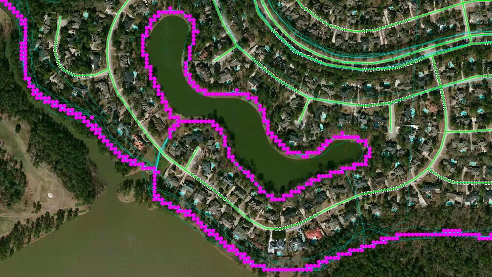
This process revealed 140,000 locations world wide where OpenStreetMap is potentially missing data. We then fed these locations into the To-Fix micro tasking manager for manual review and edits on the map. Of 140,000 potential locations we found 21,000 that actually needed an update. We only use RunKeeper data to know where to look: new paths are traced from satellite imagery where they are clearly visible, otherwise we left notes for fellow OpenStreetMap contributors.
Image may be NSFW.
Clik here to view.
To-Fix highlighting in pink missing information on the map based on RunKeeper data. We trace the trail data itself directly from satellite imagery.
