We updated our basemap in Washington, DC with aerial imagery at 3 inch (7.5 cm) resolution. The source data is openly licensed by DC.gov, thanks to the District’s open data initiative.
Image may be NSFW.
Clik here to view.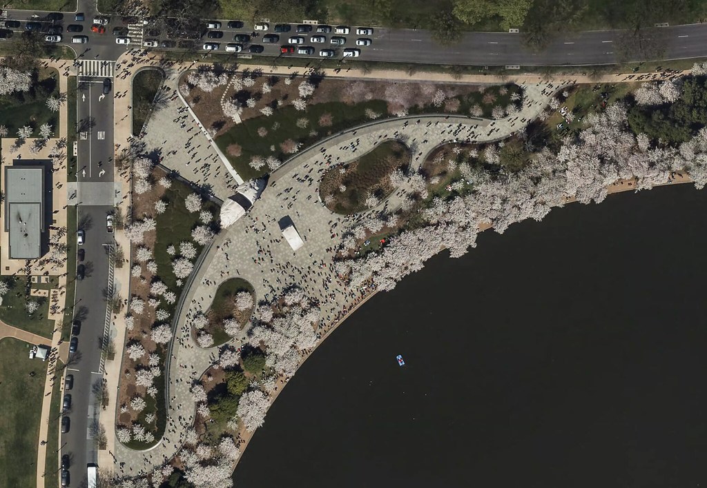 Cherry blossoms at the Martin Luther King, Jr. Memorial
Image may be NSFW.
Clik here to view. Nationals Park, in the Navy Yard neighborhood
Image may be NSFW.
Clik here to view. Union Station and its plaza, with the Thurgood Marshall Federal Judiciary Building in the lower right
Image may be NSFW.
Clik here to view. A concert in Freedom Plaza
The imagery is ready for tracing in OpenStreetMap, where its high resolution will help with detail mapping for buildings, parks, and navigation features like turn lanes.
Image may be NSFW.
Clik here to view.
Enjoy the imagery, and keep an eye on our blog for more updates!
